
Minnetonka Mills topographic map
Interactive map
Click on the map to display elevation.
About this map
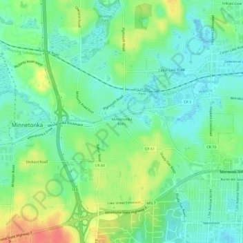
Name: Minnetonka Mills topographic map, elevation, terrain.
Average elevation: 294 m
Minimum elevation: 275 m
Maximum elevation: 329 m
Other topographic maps
Click on a map to view its topography, its elevation and its terrain.
Glen Lake
United States > Minnesota > Hennepin County > Minnetonka
Glen Lake, Minnetonka, Hennepin County, Minnesota, 55345, United States
Average elevation: 291 m