
Gârceni topographic map
Interactive map
Click on the map to display elevation.
About this map
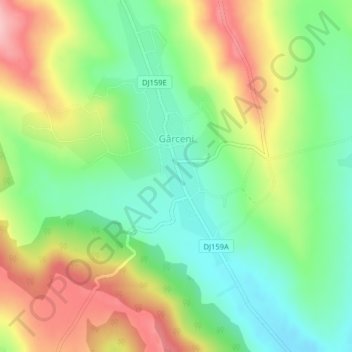
Name: Gârceni topographic map, elevation, terrain.
Location: Gârceni, Vaslui, 737260, Roumanie (46.73852 27.28971 46.76603 27.31992)
Average elevation: 267 m
Minimum elevation: 198 m
Maximum elevation: 364 m
Other topographic maps
Click on a map to view its topography, its elevation and its terrain.