Geolocate

Huntly topographic map

Click on the map to display elevation.

About this map

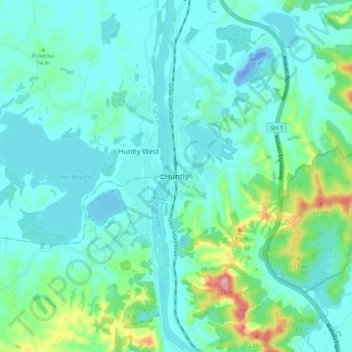
Name: Huntly topographic map, elevation, terrain.

Location: Huntly, Waikato District, Waikato, 3700, New Zealand (-37.59840 175.11883 -37.51840 175.19883)

Average elevation: 41 m

Minimum elevation: -36 m

Maximum elevation: 242 m

Gear up for your next adventure:

🍶Collapsible Water Bottles - Save space in your pack as you consume your water supply
🎒3L Hydration Reservoirs - Hands-free drinking to stay hydrated on steep contour climbs
🥾Hiking Boots - Durable hiking boots for trails and rough terrain
🥾Trail Running Shoes - Shoes for trail running
🔥Camping Stoves - Portable stoves for outdoor cooking

As an Amazon Associate, this site earns from qualifying purchases at no extra cost to you.