
信義鄉 topographic map
Interactive map
Click on the map to display elevation.
About this map
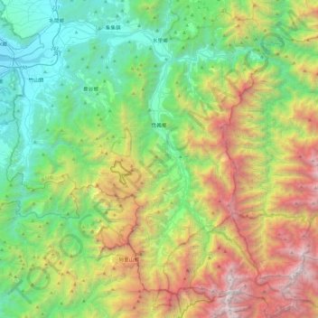
Name: 信義鄉 topographic map, elevation, terrain.
Location: 信義鄉, Comté de Nantou, Province de Taïwan, Taïwan (23.43520 120.80394 23.86479 121.24130)
Average elevation: 1,329 m
Minimum elevation: 82 m
Maximum elevation: 3,882 m