Geolocate

Monte Rio topographic map

Click on the map to display elevation.

About this map

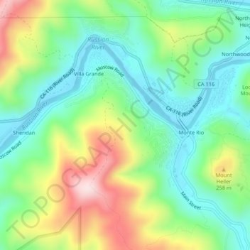
Name: Monte Rio topographic map, elevation, terrain.

Location: Monte Rio, Sonoma County, California, 95486, United States (38.45577 -123.03198 38.47698 -122.99132)

Average elevation: 131 m

Minimum elevation: -1 m

Maximum elevation: 378 m

Other topographic maps

Click on a map to view its topography, its elevation and its terrain.

Gear up for your next adventure:

GPS Watches - GPS watches for outdoor sports
🌬️Windbreaker Jackets - Wind protection jackets
📻Handheld UHF Radios - Critical communication for groups in the Australian outback
🦶Orthotic Hiking Insoles - Extra arch support for long-distance topographic treks
📱Tablet Tripod Mounts - Steady platforms for viewing digital maps or taking long exposures

As an Amazon Associate, this site earns from qualifying purchases at no extra cost to you.