
Thank you for supporting this site ❤️
Make a donation
Make a donation
Gear up for your next adventure:
As an Amazon Associate, this site earns from qualifying purchases at no extra cost to you.
Dudhia topographic map
Click on the map to display elevation.
Thank you for supporting this site ❤️
Make a donation
Make a donation
Gear up for your next adventure:
As an Amazon Associate, this site earns from qualifying purchases at no extra cost to you.
About this map
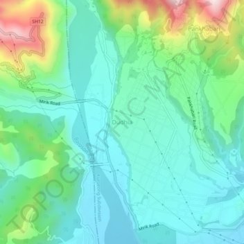
Name: Dudhia topographic map, elevation, terrain.
Location: Dudhia, Kurseong Subdivision, Darjeeling, West Bengal, India (26.79822 88.22971 26.83822 88.26971)
Average elevation: 381 m
Minimum elevation: 245 m
Maximum elevation: 795 m
Thank you for supporting this site ❤️
Make a donation
Make a donation
Gear up for your next adventure:
As an Amazon Associate, this site earns from qualifying purchases at no extra cost to you.