
Mesquite topographic map
Interactive map
Click on the map to display elevation.
About this map
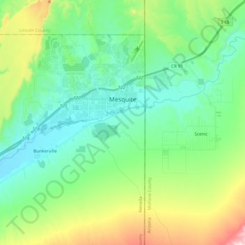
Name: Mesquite topographic map, elevation, terrain.
Location: Mesquite, Clark County, Nevada, Verenigde Staten (36.73485 -114.23795 36.84339 -114.04999)
Average elevation: 602 m
Minimum elevation: 453 m
Maximum elevation: 1,015 m
Other topographic maps
Click on a map to view its topography, its elevation and its terrain.
Lake Mead
Verenigde Staten > Nevada > Clark County
Lake Mead, Clark County, Nevada, Verenigde Staten
Average elevation: 684 m
Lake Mohave
Verenigde Staten > Nevada > Clark County
Lake Mohave, Clark County, Nevada, Verenigde Staten
Average elevation: 262 m
Las Vegas
Verenigde Staten > Nevada > Clark County
Las Vegas, Clark County, Nevada, Verenigde Staten
Average elevation: 756 m