Geolocate

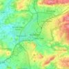
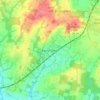
Coldwaltham topographic map

Click on the map to display elevation.

About this map

Name: Coldwaltham topographic map, elevation, terrain.

Location: Coldwaltham, Horsham, West Sussex, England, United Kingdom (50.92339 -0.56904 50.95659 -0.50167)

Average elevation: 12 m

Minimum elevation: -3 m

Maximum elevation: 61 m

Other topographic maps

Click on a map to view its topography, its elevation and its terrain.
Cootham

United Kingdom > England > West Sussex > Horsham > Storrington

Average elevation: 51 m

Horsham

United Kingdom > England > West Sussex > Horsham

Average elevation: 62 m

Wiggonholt

United Kingdom > England > West Sussex > Horsham > Wiggonholt

Average elevation: 17 m

Hardham

United Kingdom > England > West Sussex > Horsham > Coldwaltham

Average elevation: 13 m

Wineham

United Kingdom > England > West Sussex > Horsham

Average elevation: 18 m

Barns Green

United Kingdom > England > West Sussex > Horsham

Average elevation: 49 m

Horsham

United Kingdom > England > West Sussex > Horsham

Average elevation: 62 m

Hardham

United Kingdom > England > West Sussex > Horsham > Coldwaltham

Average elevation: 13 m

Horsham

United Kingdom > England > West Sussex > Horsham

Average elevation: 62 m

Gear up for your next adventure:

🩹Wilderness First Aid Kits - Comprehensive medical kits tailored for hiking and remote exploration
🎒Hiking Backpacks - Backpacks designed for hiking and trekking
🥾Hiking Shoes - Lightweight hiking shoes for day hikes
📍Handheld GPS - GPS devices for hiking and navigation
📣High-Decibel Survival Whistles - Signaling tool for rescue that carries much further than a human voice

As an Amazon Associate, this site earns from qualifying purchases at no extra cost to you.