
El Tejar topographic map
Interactive map
Click on the map to display elevation.
About this map
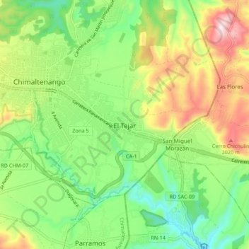
Name: El Tejar topographic map, elevation, terrain.
Location: El Tejar, Chimaltenango, 4001, Guatemala (14.60742 -90.83099 14.68742 -90.75099)
Average elevation: 1,793 m
Minimum elevation: 1,591 m
Maximum elevation: 2,115 m