Geolocate

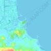
Dap-Dap topographic map

Click on the map to display elevation.

About this map

Name: Dap-Dap topographic map, elevation, terrain.

Location: Dap-Dap, Legazpi, Albay, Bicol Region, 4500, Philippines (13.12080 123.73815 13.16080 123.77815)

Average elevation: 15 m

Minimum elevation: 0 m

Maximum elevation: 112 m

Other topographic maps

Click on a map to view its topography, its elevation and its terrain.
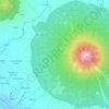
Mayon Volcano

Philippines > Albay > Legazpi

Average elevation: 519 m

Sawangan Park

Philippines > Albay > Legazpi

Average elevation: 7 m

Kalayaan Park

Philippines > Albay > Legazpi

Average elevation: 7 m

Tibu River

Philippines > Albay > Legazpi > Tamaoyan

Average elevation: 4 m

Gear up for your next adventure:

🛰️Handheld GPS Units - Rugged GPS devices for tracking coordinates and elevation in the Australian bush
🔋Solar Power Banks - Solar chargers for outdoors
🔥Ferrocerium Rod Fire Starters - Reliable fire lighting in wet or windy conditions without matches
🔪Outdoor Multi-tools - Versatile tools for gear repair and survival tasks in the wilderness
🧺Waterproof Dry Sacks - Organize your pack and keep electronics safe from rain and river crossings

As an Amazon Associate, this site earns from qualifying purchases at no extra cost to you.