
Thank you for supporting this site ❤️
Make a donation
Make a donation
Gear up for your next adventure:
As an Amazon Associate, this site earns from qualifying purchases at no extra cost to you.
Pag-asa topographic map
Click on the map to display elevation.
Thank you for supporting this site ❤️
Make a donation
Make a donation
Gear up for your next adventure:
As an Amazon Associate, this site earns from qualifying purchases at no extra cost to you.
About this map
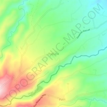
Name: Pag-asa topographic map, elevation, terrain.
Location: Pag-asa, Orani, Bataan, Central Luzon, 2112, Philippines (14.74909 120.43236 14.78909 120.47236)
Average elevation: 223 m
Minimum elevation: 101 m
Maximum elevation: 411 m
Thank you for supporting this site ❤️
Make a donation
Make a donation
Gear up for your next adventure:
As an Amazon Associate, this site earns from qualifying purchases at no extra cost to you.