
Landhi Town topographic map
Interactive map
Click on the map to display elevation.
About this map
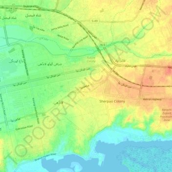
Name: Landhi Town topographic map, elevation, terrain.
Location: Landhi Town, Karachi, Karāchi District, Sindh, 75120, Pakistan (24.81914 67.13864 24.86856 67.24096)
Average elevation: 19 m
Minimum elevation: -1 m
Maximum elevation: 42 m
Other topographic maps
Click on a map to view its topography, its elevation and its terrain.