Geolocate

High River topographic map

Click on the map to display elevation.

About this map

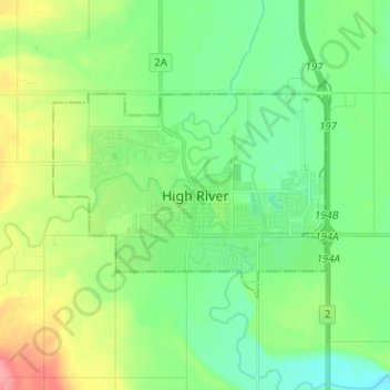
Name: High River topographic map, elevation, terrain.

Location: High River, Town of High River, Alberta, T1V 1R6, Canada (50.54019 -113.91093 50.62019 -113.83093)

Average elevation: 1,042 m

Minimum elevation: 1,016 m

Maximum elevation: 1,098 m

Gear up for your next adventure:

🧥Packable Rain Jackets - Breathable waterproof layers for unpredictable mountain weather
📦Crushproof Equipment Cases - Safe transport for sensitive surveying and mapping instruments
🧭Global Orienteering Compass - High-precision liquid-filled compasses for accurate map reading and navigation
🦘Outback Survival Gear - Essential gear for Australian outback
🛠️Outdoor Repair Kits - Gear repair kits

As an Amazon Associate, this site earns from qualifying purchases at no extra cost to you.