
Arbieto topographic map
Interactive map
Click on the map to display elevation.
About this map
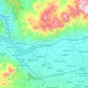
Name: Arbieto topographic map, elevation, terrain.
Location: Arbieto, Esteban Arze, Cochabamba, Bolivia (-17.61521 -66.13938 -17.46895 -65.95619)
Average elevation: 2,911 m
Minimum elevation: 2,645 m
Maximum elevation: 3,792 m
Other topographic maps
Click on a map to view its topography, its elevation and its terrain.
Tarata
Bolivia > Cochabamba > Esteban Arze
Tarata, Esteban Arze, Cochabamba, Bolivia
Average elevation: 3,017 m