Geolocate

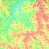
Waterloo State Wildlife Management Area topographic map

Click on the map to display elevation.

About this map

Name: Waterloo State Wildlife Management Area topographic map, elevation, terrain.

Location: Waterloo State Wildlife Management Area, Waterloo Township, Athens County, Ohio, United States (39.32373 -82.29478 39.37104 -82.25265)

Average elevation: 267 m

Minimum elevation: 209 m

Maximum elevation: 329 m

Other topographic maps

Click on a map to view its topography, its elevation and its terrain.
Stringtown

United States > Ohio > Athens County

Average elevation: 230 m

Nelsonville

United States > Ohio > Athens County

Average elevation: 247 m

Glouster

United States > Ohio > Athens County

Average elevation: 235 m

Lodi Township

United States > Ohio > Athens County

Average elevation: 255 m

La Mar Heights

United States > Ohio > Athens County > Athens

Average elevation: 238 m

Grosvenor Crossing

United States > Ohio > Athens County > Athens

Average elevation: 222 m

Athens

United States > Ohio > Athens County

Average elevation: 240 m

Glouster

United States > Ohio > Athens County

Average elevation: 235 m

Hockingport

United States > Ohio > Athens County

Average elevation: 210 m

Alexander Township

United States > Ohio > Athens County

Average elevation: 250 m

Shade

United States > Ohio > Athens County

Average elevation: 258 m

Albany

United States > Ohio > Athens County

Average elevation: 235 m

Amesville

United States > Ohio > Athens County

Amesville is situated in the foothills of the Appalachian Mountains, approximately 45 miles south by southeast of the terminal moraine, a topographical feature often associated with the boundaries of glaciers, and is surrounded by wooded hills, narrow valleys, and numerous creeks flanked by lowland pastures…

Average elevation: 223 m

La Mar Heights

United States > Ohio > Athens County > Athens

Average elevation: 238 m

Gear up for your next adventure:

🦶Orthotic Hiking Insoles - Extra arch support for long-distance topographic treks
📚Map Reading & Navigation Guides - Master the art of interpreting topographic contours and symbols
🎒3L Hydration Reservoirs - Hands-free drinking to stay hydrated on steep contour climbs
📟Satellite Messengers - Two-way satellite communication to stay in touch beyond the cellular grid
🔥Windproof Plasma Lighters - USB rechargeable lighters that work in high-altitude winds

As an Amazon Associate, this site earns from qualifying purchases at no extra cost to you.