
Sidama topographic map
Interactive map
Click on the map to display elevation.
About this map
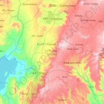
Name: Sidama topographic map, elevation, terrain.
Location: Sidama, Éthiopie (6.13875 37.90643 7.16567 39.13272)
Average elevation: 2,050 m
Minimum elevation: 1,172 m
Maximum elevation: 3,289 m
Other topographic maps
Click on a map to view its topography, its elevation and its terrain.