Geolocate

Valley Center topographic map

Click on the map to display elevation.

About this map

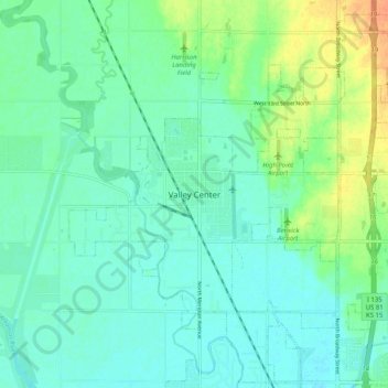
Name: Valley Center topographic map, elevation, terrain.

Location: Valley Center, Sedgwick County, Kansas, United States (37.79473 -97.41338 37.87473 -97.33338)

Average elevation: 415 m

Minimum elevation: 405 m

Maximum elevation: 441 m

Gear up for your next adventure:

👟Lightweight Trail Runners - Agile footwear for fast movement over rugged Australian terrain
Ultralight Solo Tents - Compact shelters for multi-day topographic surveying expeditions
Altimeter Barometer Watches - Outdoor watches with built-in sensors to track altitude changes and weather shifts
🔋Rechargeable Batteries - Eco-friendly power for high-drain GPS units and flashlights
🧣Merino Neck Gaiters - Versatile headwear for warmth, sun protection, or dust filtering

As an Amazon Associate, this site earns from qualifying purchases at no extra cost to you.