
Ban Mae Kha Mu Noi topographic map
Interactive map
Click on the map to display elevation.
About this map
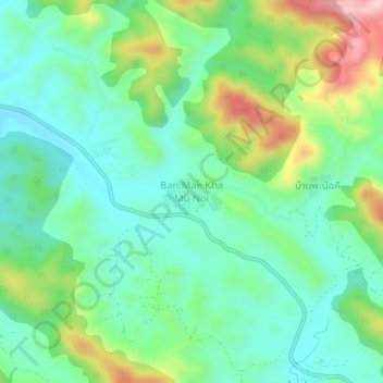
Name: Ban Mae Kha Mu Noi topographic map, elevation, terrain.
Location: Ban Mae Kha Mu Noi, ターク県, タイ王国 (17.18777 98.29597 17.22777 98.33597)
Average elevation: 258 m
Minimum elevation: 175 m
Maximum elevation: 450 m
Other topographic maps
Click on a map to view its topography, its elevation and its terrain.