
Thank you for supporting this site ❤️
Make a donation
Make a donation
Gear up for your next adventure:
As an Amazon Associate, this site earns from qualifying purchases at no extra cost to you.
Oyoor topographic map
Click on the map to display elevation.
Thank you for supporting this site ❤️
Make a donation
Make a donation
Gear up for your next adventure:
As an Amazon Associate, this site earns from qualifying purchases at no extra cost to you.
About this map
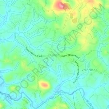
Name: Oyoor topographic map, elevation, terrain.
Location: Oyoor, Kottarakkara, Kollam, Kerala, 691510, India (8.85483 76.75348 8.89483 76.79348)
Average elevation: 40 m
Minimum elevation: 6 m
Maximum elevation: 133 m
Thank you for supporting this site ❤️
Make a donation
Make a donation
Gear up for your next adventure:
As an Amazon Associate, this site earns from qualifying purchases at no extra cost to you.