Geolocate

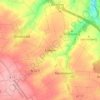
Segnitz topographic map

Click on the map to display elevation.

About this map

Name: Segnitz topographic map, elevation, terrain.

Location: Segnitz, Marktbreit (VGem), Landkreis Kitzingen, Bavaria, Germany (49.66740 10.12094 49.68871 10.14896)

Average elevation: 214 m

Minimum elevation: 175 m

Maximum elevation: 276 m

Other topographic maps

Click on a map to view its topography, its elevation and its terrain.
Euerfeld

Germany > Bavaria > Landkreis Kitzingen > Dettelbach

Average elevation: 276 m

Enheim

Germany > Bavaria > Landkreis Kitzingen

Average elevation: 290 m

Köhler

Germany > Bavaria > Landkreis Kitzingen > Volkach

Average elevation: 252 m

Langenberg

Germany > Bavaria > Landkreis Kitzingen

Average elevation: 399 m

Gear up for your next adventure:

💧Personal Water Filters - Drink safely from streams and lakes identified on your map
☕Outdoor Coffee Makers - Enjoy quality coffee at the summit of your favorite peak
🧊Insulated Cooler Bags - Keep food fresh for day trips to remote geographic sites
🔦Headlamps - Hands-free lighting for hiking
🚗Car Camping Gear - Equipment for vehicle camping

As an Amazon Associate, this site earns from qualifying purchases at no extra cost to you.