Geolocate

Kihei topographic map

Click on the map to display elevation.

About this map

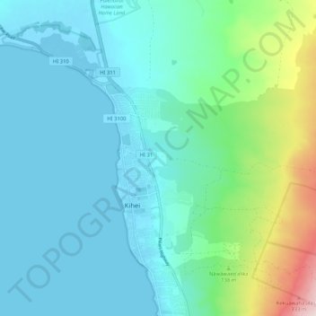
Name: Kihei topographic map, elevation, terrain.

Location: Kihei, Maui County, Hawaii, United States (20.71347 -156.49069 20.81071 -156.40079)

Average elevation: 74 m

Minimum elevation: -5 m

Maximum elevation: 405 m

Gear up for your next adventure:

🧺Waterproof Dry Sacks - Organize your pack and keep electronics safe from rain and river crossings
💧Personal Water Filters - Drink safely from streams and lakes identified on your map
📷Backpack Camera Clips - Quick access to your camera while keeping your hands free for climbing
🧤Thermal Hiking Gloves - Keep your hands warm and functional during high-altitude winter treks
🪫Rechargeable Headlamps - USB rechargeable headlamps

As an Amazon Associate, this site earns from qualifying purchases at no extra cost to you.