Geolocate

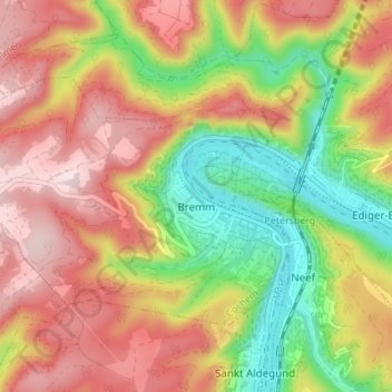
Bremm topographic map

Click on the map to display elevation.

Bremm

The municipality lies at a bow in the river Moselle between Trier and Koblenz, among the sloped vineyards of the Calmont, which with an elevation of 380 m above sea level and a slope of roughly 65° is Europe’s steepest vineyard location. This stretches along the Moselle from Ediger-Eller to Bremm, and is part of the Mosel wine region.

Wikipedia (CC-BY-SA 3.0)

About this map

Name: Bremm topographic map, elevation, terrain.

Location: Bremm, Cochem, Landkreis Cochem-Zell, Rhineland-Palatinate, Germany (50.08509 7.06760 50.11395 7.13606)

Average elevation: 258 m

Minimum elevation: 77 m

Maximum elevation: 422 m

Gear up for your next adventure:

🧴Sunscreen SPF - Sun protection for outdoor activities
👄SPF Lip Balm - Prevent sun and wind-burnt lips on mountain ridges
🔥Windproof Plasma Lighters - USB rechargeable lighters that work in high-altitude winds
🧼Clip-on Hand Sanitizer - Maintain hygiene when water for washing is scarce
🧥Softshell Jackets - Flexible outdoor jackets

As an Amazon Associate, this site earns from qualifying purchases at no extra cost to you.