
Azangaro topographic map
Interactive map
Click on the map to display elevation.
About this map
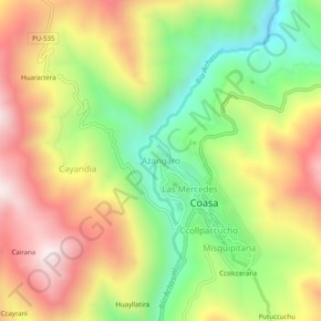
Name: Azangaro topographic map, elevation, terrain.
Location: Azangaro, Coasa, Carabaya, Puno, Perú (-14.00116 -70.04274 -13.96116 -70.00274)
Average elevation: 3,939 m
Minimum elevation: 3,529 m
Maximum elevation: 4,374 m