
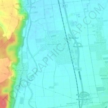
Westendorf topographic map
Interactive map
Click on the map to display elevation.
About this map
Name: Westendorf topographic map, elevation, terrain.
Average elevation: 433 m
Minimum elevation: 419 m
Maximum elevation: 492 m
Other topographic maps
Click on a map to view its topography, its elevation and its terrain.
Westendorf
Allemagne > Bavière > Augsburg (arrondissement) > Westendorf > Westendorf
Westendorf, Nordendorf, Augsburg (arrondissement), Bavière, 86707, Allemagne
Average elevation: 436 m
Foret
Allemagne > Bavière > Augsburg (arrondissement)
Foret, Langweid am Lech, Augsburg (arrondissement), Bavière, 86462, Allemagne
Average elevation: 453 m
Waltershofen
Allemagne > Bavière > Augsburg (arrondissement) > Meitingen > Waltershofen
Waltershofen, Meitingen, Augsburg (arrondissement), Bavière, 86405, Allemagne
Average elevation: 427 m