Geolocate

Mam Tor topographic map

Click on the map to display elevation.

About this map
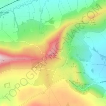
Name: Mam Tor topographic map, elevation, terrain.

Location: Mam Tor, High Peak, Derbyshire, East Midlands, England, S33 8WA, United Kingdom (53.34921 -1.80969 53.34931 -1.80959)

Average elevation: 347 m

Minimum elevation: 205 m

Maximum elevation: 541 m

Gear up for your next adventure:

🛰️Handheld GPS Units - Rugged GPS devices for tracking coordinates and elevation in the Australian bush
🪑Portable Backpacking Chairs - A comfortable seat for studying maps at the end of the day
🔋Solar Power Banks - Charge your phone and GPS using the sun while deep in the bush
🧭Military Style Lensatic Compass - Durable sighting compasses for advanced land navigation and surveying
⌚Altimeter Barometer Watches - Outdoor watches with built-in sensors to track altitude changes and weather shifts

As an Amazon Associate, this site earns from qualifying purchases at no extra cost to you.