Geolocate

Murrawong topographic map

Click on the map to display elevation.

About this map

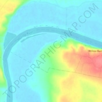
Name: Murrawong topographic map, elevation, terrain.

Location: Murrawong, The Rural City of Murray Bridge, South Australia, 5253, Australia (-35.06144 139.31670 -35.05000 139.34373)

Average elevation: 19 m

Minimum elevation: -1 m

Maximum elevation: 71 m

Other topographic maps

Click on a map to view its topography, its elevation and its terrain.

Woods Point

Australia > South Australia > The Rural City of Murray Bridge

Woods Point, The Rural City of Murray Bridge, South Australia, 5253, Australia

Average elevation: 16 m

Mobilong

Australia > South Australia > The Rural City of Murray Bridge

Mobilong, The Rural City of Murray Bridge, South Australia, 5253, Australia

Average elevation: 15 m

Pallamana

Australia > South Australia > The Rural City of Murray Bridge

Pallamana, The Rural City of Murray Bridge, South Australia, 5254, Australia

Average elevation: 80 m

Sunnyside

Australia > South Australia > The Rural City of Murray Bridge

Sunnyside, The Rural City of Murray Bridge, South Australia, 5253, Australia

Average elevation: 37 m

Murray Bridge

Australia > South Australia > The Rural City of Murray Bridge

Murray Bridge, The Rural City of Murray Bridge, South Australia, 5253, Australia

Average elevation: 34 m

Monarto

Australia > South Australia > The Rural City of Murray Bridge

Monarto, The Rural City of Murray Bridge, South Australia, 5254, Australia

Average elevation: 148 m

Monarto South

Australia > South Australia > The Rural City of Murray Bridge

Monarto South, The Rural City of Murray Bridge, South Australia, 5254, Australia

Average elevation: 86 m

Lake Alexandrina

Australia > South Australia > The Rural City of Murray Bridge

Lake Alexandrina, The Rural City of Murray Bridge, South Australia, Australia

Average elevation: 6 m

In order to remain free and to keep improving, this site uses cookies created by Google to compile visit statistics and display personalized advertisements.

How is the collected data used?