Geolocate

Zoom topographic map

Click on the map to display elevation.

About this map

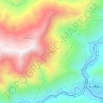
Name: Zoom topographic map, elevation, terrain.

Location: Zoom, Soreng, Soreng District, Sikkim, India (27.12501 88.24335 27.16501 88.28335)

Average elevation: 864 m

Minimum elevation: 301 m

Maximum elevation: 1,547 m

Gear up for your next adventure:

🧰Survival Kits - Essential survival gear
🥾Heavy Duty Hiking Boots - Ankle-supporting boots for carrying heavy packs on steep contours
🥶Thermal Beanies - Warm hats for cold hikes
🧴Sunscreen SPF - Sun protection for outdoor activities
🥾Hiking Boots - Durable hiking boots for trails and rough terrain

As an Amazon Associate, this site earns from qualifying purchases at no extra cost to you.