
Thank you for supporting this site ❤️
Make a donation
Make a donation
Gear up for your next adventure:
As an Amazon Associate, this site earns from qualifying purchases at no extra cost to you.
Dharapani topographic map
Click on the map to display elevation.
Thank you for supporting this site ❤️
Make a donation
Make a donation
Gear up for your next adventure:
As an Amazon Associate, this site earns from qualifying purchases at no extra cost to you.
About this map
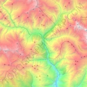
Name: Dharapani topographic map, elevation, terrain.
Location: Dharapani, Nashong, Manang, Gandaki Pradesh, Nepal (28.44493 84.26858 28.56145 84.57149)
Average elevation: 3,706 m
Minimum elevation: 1,083 m
Maximum elevation: 6,488 m
Thank you for supporting this site ❤️
Make a donation
Make a donation
Gear up for your next adventure:
As an Amazon Associate, this site earns from qualifying purchases at no extra cost to you.