Geolocate

Superior topographic map

Click on the map to display elevation.

About this map
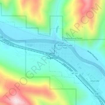
Name: Superior topographic map, elevation, terrain.

Location: Superior, Mineral County, Montana, 59872, United States (47.18379 -114.91547 47.20250 -114.86917)

Average elevation: 981 m

Minimum elevation: 809 m

Maximum elevation: 1,401 m

Other topographic maps

Click on a map to view its topography, its elevation and its terrain.

Saltese

United States > Montana > Mineral County

Average elevation: 1,259 m

Mount Baldy

United States > Montana > Mineral County

Average elevation: 1,782 m

Gear up for your next adventure:

🆘Personal Locator Beacons (PLB) - Satellite emergency beacons for life-saving help in areas with no mobile coverage
💡Collapsible Camping Lanterns - Illuminate your base camp or tent for map studying at night
🥤Outdoor Water Bottles - Reusable bottles for outdoor activities
🛌Sleeping Mats - Insulated mats for camping comfort
🎒Daypacks - Compact backpacks for short hikes

As an Amazon Associate, this site earns from qualifying purchases at no extra cost to you.