
La Catedral topographic map
Interactive map
Click on the map to display elevation.
About this map
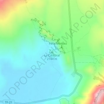
Name: La Catedral topographic map, elevation, terrain.
Average elevation: 2,118 m
Minimum elevation: 2,001 m
Maximum elevation: 2,437 m
Other topographic maps
Click on a map to view its topography, its elevation and its terrain.
Las Lajitas
Las Lajitas, La Orotava, Santa Cruz de Tenerife, Canarias, 38999, España
Average elevation: 1,172 m
La Orotava
España > La Orotava > La Orotava
La Orotava, Santa Cruz de Tenerife, Canarias, España
Average elevation: 1,257 m