Geolocate

Alathur topographic map

Click on the map to display elevation.

About this map

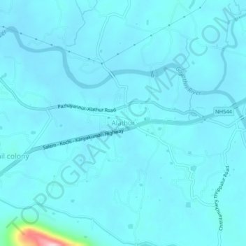
Name: Alathur topographic map, elevation, terrain.

Location: Alathur, Palakkad, Kerala, 678541, India (10.62590 76.52361 10.66590 76.56361)

Average elevation: 66 m

Minimum elevation: 47 m

Maximum elevation: 325 m

Other topographic maps

Click on a map to view its topography, its elevation and its terrain.

Chembai

India > Kerala > Alathur > Kottayi

Average elevation: 68 m

Mannapra

India > Kerala > Alathur > Puthucode

Average elevation: 52 m

Thodukadu

India > Kerala > Alathur > muthannod

Average elevation: 89 m

Gear up for your next adventure:

🎒Ultralight Backpacks - Lightweight packs for long hikes
🕶️Polarized Outdoor Sunglasses - Reduce glare from rocks and water for better visual navigation
📱Tablet Tripod Mounts - Steady platforms for viewing digital maps or taking long exposures
🔭Compact Hiking Binoculars - Lightweight optics for scouting routes or birdwatching
🏫Topographic World Globes - 3D physical relief globes to understand global geography

As an Amazon Associate, this site earns from qualifying purchases at no extra cost to you.