Geolocate

Borken topographic map

Click on the map to display elevation.

About this map
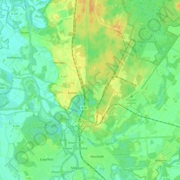
Name: Borken topographic map, elevation, terrain.

Location: Borken, Meppen, Landkreis Emsland, Lower Saxony, Germany (52.70755 7.23321 52.74374 7.35107)

Average elevation: 18 m

Minimum elevation: 7 m

Maximum elevation: 35 m

Other topographic maps

Click on a map to view its topography, its elevation and its terrain.

Mühlenmoor

Germany > Lower Saxony > Landkreis Emsland > Meppen > Helte

Average elevation: 17 m

Gear up for your next adventure:

🧺Waterproof Dry Sacks - Organize your pack and keep electronics safe from rain and river crossings
🔌Fast Charging Adapters - Quickly top up all your gear before heading back into the field
⌚Altimeter Watches - Watches with altitude tracking
🎒Tactical Waist Packs - Quick access to your compass, phone, and snacks while walking
📸Action Cameras - Record your journey across interesting topographic features in 4K

As an Amazon Associate, this site earns from qualifying purchases at no extra cost to you.