
Qena topographic map
Interactive map
Click on the map to display elevation.
About this map
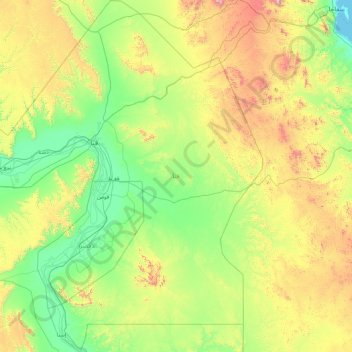
Name: Qena topographic map, elevation, terrain.
Location: Qena, Egypt (25.21014 31.92994 26.80027 33.56617)
Average elevation: 342 m
Minimum elevation: 0 m
Maximum elevation: 1,381 m
Other topographic maps
Click on a map to view its topography, its elevation and its terrain.