
仁愛鄉 topographic map
Interactive map
Click on the map to display elevation.
About this map
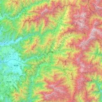
Name: 仁愛鄉 topographic map, elevation, terrain.
Location: 仁愛鄉, Comté de Nantou, Province de Taïwan, 546, Taïwan (23.80915 120.93750 24.24588 121.34942)
Average elevation: 1,669 m
Minimum elevation: 346 m
Maximum elevation: 3,576 m