
Charaudet topographic map
Interactive map
Click on the map to display elevation.
About this map
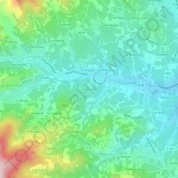
Name: Charaudet topographic map, elevation, terrain.
Average elevation: 339 m
Minimum elevation: 235 m
Maximum elevation: 652 m
Other topographic maps
Click on a map to view its topography, its elevation and its terrain.
69460
France > Auvergne-Rhône-Alpes > Rhône > Le Perréon > Le Delèche
69460, Le Delèche, Le Perréon, Villefranche-sur-Saône, Rhône, Auvergne-Rhône-Alpes, France métropolitaine, France
Average elevation: 340 m