
Porttipahta topographic map
Interactive map
Click on the map to display elevation.
About this map
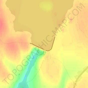
Name: Porttipahta topographic map, elevation, terrain.
Average elevation: 240 m
Minimum elevation: 206 m
Maximum elevation: 256 m
Other topographic maps
Click on a map to view its topography, its elevation and its terrain.
Kakslauttanen
Finlande > Finlande septentrionale > Sodankylä
Kakslauttanen, Sodankylä, Pohjois-Lapin seutukunta, Lappi, Lapin aluehallintovirasto, Finlande septentrionale, Manner-Suomi, Finlande
Average elevation: 301 m