
Make a donation
Gear up for your next adventure:
As an Amazon Associate, this site earns from qualifying purchases at no extra cost to you.
Cambridge topographic map
Click on the map to display elevation.
Make a donation
Gear up for your next adventure:
As an Amazon Associate, this site earns from qualifying purchases at no extra cost to you.
Cambridge
Cambridge obtains water from Hobbs Brook (in Lincoln and Waltham) and Stony Brook (Waltham and Weston), as well as an emergency connection to the Massachusetts Water Resources Authority. The city owns over 1,200 acres (486 ha) of land in other towns that includes these reservoirs and portions of their watershed. Water from these reservoirs flows by gravity through an aqueduct to Fresh Pond in Cambridge. It is then treated in an adjacent plant and pumped uphill to an elevation of 176 feet (54 m) above sea level at the Payson Park Reservoir (Belmont). The water is then redistributed downhill via gravity to individual users in the city. A new water treatment plant opened in 2001.
Make a donation
Gear up for your next adventure:
As an Amazon Associate, this site earns from qualifying purchases at no extra cost to you.
About this map
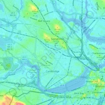
Name: Cambridge topographic map, elevation, terrain.
Location: Cambridge, Middlesex County, Massachusetts, United States (42.35240 -71.16040 42.40426 -71.06398)
Average elevation: 11 m
Minimum elevation: -5 m
Maximum elevation: 73 m
Make a donation
Gear up for your next adventure:
As an Amazon Associate, this site earns from qualifying purchases at no extra cost to you.
Other topographic maps
Click on a map to view its topography, its elevation and its terrain.
Picking Conservation Land East
United States > Massachusetts > Middlesex County > Westford
Average elevation: 73 m
Bowman Park
United States > Massachusetts > Middlesex County > Lexington > East Lexington
Average elevation: 70 m
Make a donation
Gear up for your next adventure:
As an Amazon Associate, this site earns from qualifying purchases at no extra cost to you.
Lowell
United States > Massachusetts > Middlesex County > Lowell
Lowell is located at the confluence of the Merrimack and Concord rivers. The Pawtucket Falls, a mile-long set of rapids with a total drop in elevation of 32 feet, ends where the two rivers meet. At the top of the falls is the Pawtucket Dam, designed to turn the upper Merrimack into a millpond, diverted through…
Average elevation: 55 m