Geolocate

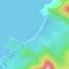
Milagrosa topographic map

Click on the map to display elevation.

About this map

Name: Milagrosa topographic map, elevation, terrain.

Location: Milagrosa, Puerto Princesa, Mimaropa, Philippines (9.71565 118.72711 9.75565 118.76711)

Average elevation: 8 m

Minimum elevation: 0 m

Maximum elevation: 24 m

Other topographic maps

Click on a map to view its topography, its elevation and its terrain.

Baywalk Park

Philippines > Puerto Princesa

Average elevation: 6 m

Bacungan River

Philippines > Puerto Princesa

Average elevation: 123 m

Irawan River

Philippines > Puerto Princesa

Average elevation: 120 m

Tagkawayan Beach

Philippines > Puerto Princesa

Average elevation: 48 m

Sabang River

Philippines > Puerto Princesa

Average elevation: 39 m

Manors Verdant

Philippines > Puerto Princesa

Average elevation: 5 m

Gear up for your next adventure:

🪢550 Survival Paracord - Versatile cordage for gear repair and emergency lashing
📕Hiking Guide Books - Guides for hiking trails
🦟Heavy Duty Insect Repellent - Essential protection against flies, mozzies, and march flies
🔭Compact Hiking Binoculars - Lightweight optics for scouting routes or birdwatching
🖼️Scratch-off Australia Map - Track the regions and peaks you have explored geographically

As an Amazon Associate, this site earns from qualifying purchases at no extra cost to you.