
Mount Baker topographic map
Interactive map
Click on the map to display elevation.
About this map
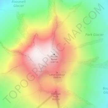
Name: Mount Baker topographic map, elevation, terrain.
Average elevation: 2,699 m
Minimum elevation: 2,182 m
Maximum elevation: 3,274 m
Other topographic maps
Click on a map to view its topography, its elevation and its terrain.
Lynden
Vereinigte Staaten von Amerika > Washington > Whatcom County
Lynden, Whatcom County, Washington, Vereinigte Staaten von Amerika
Average elevation: 26 m