Geolocate

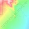
Burley topographic map

Click on the map to display elevation.

About this map

Name: Burley topographic map, elevation, terrain.

Location: Burley, Cassia County, Idaho, 83318, United States (42.51124 -113.83323 42.56857 -113.75570)

Average elevation: 1,268 m

Minimum elevation: 1,258 m

Maximum elevation: 1,284 m

Other topographic maps

Click on a map to view its topography, its elevation and its terrain.

Almo

United States > Idaho > Cassia County

Average elevation: 1,656 m

Sawtooth

United States > Idaho > Cassia County

Average elevation: 1,845 m

Thunder Mountain

United States > Idaho > Cassia County

Average elevation: 1,991 m

Smoky Mountain

United States > Idaho > Cassia County

Average elevation: 1,976 m

Heglar

United States > Idaho > Cassia County

Average elevation: 1,480 m

Gear up for your next adventure:

🌿Flora and Fauna Field Guides - Identify the plants and animals you encounter on your route
🦯Trekking Poles - Walking poles for hiking stability
🍳Ultralight Camping Stoves - Boil water quickly for meals using minimal fuel
📷Backpack Camera Clips - Quick access to your camera while keeping your hands free for climbing
🦶Orthotic Hiking Insoles - Extra arch support for long-distance topographic treks

As an Amazon Associate, this site earns from qualifying purchases at no extra cost to you.