
Convención topographic map
Interactive map
Click on the map to display elevation.
About this map
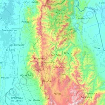
Name: Convención topographic map, elevation, terrain.
Location: Convención, Occidente, Norte de Santander, Colombia (7.88338 -73.98307 9.28338 -72.58307)
Average elevation: 545 m
Minimum elevation: 13 m
Maximum elevation: 3,325 m