
Pino Verde topographic map
Interactive map
Click on the map to display elevation.
About this map
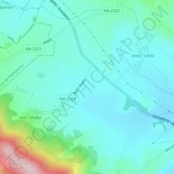
Name: Pino Verde topographic map, elevation, terrain.
Location: Pino Verde, Lizoain-Arriasgoiti, Prepirineo, Navarra, España (42.79206 -1.51122 42.81206 -1.49122)
Average elevation: 577 m
Minimum elevation: 517 m
Maximum elevation: 835 m
Other topographic maps
Click on a map to view its topography, its elevation and its terrain.
Redín
España > Navarra > Prepirineo > Lizoain-Arriasgoiti
Redín, Lizoain-Arriasgoiti, Prepirineo, Navarra, España
Average elevation: 594 m