
Thank you for supporting this site ❤️
Make a donation
Make a donation
Gear up for your next adventure:
As an Amazon Associate, this site earns from qualifying purchases at no extra cost to you.
Genthin topographic map
Click on the map to display elevation.
Thank you for supporting this site ❤️
Make a donation
Make a donation
Gear up for your next adventure:
As an Amazon Associate, this site earns from qualifying purchases at no extra cost to you.
About this map
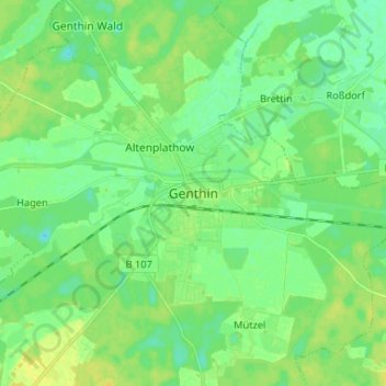
Name: Genthin topographic map, elevation, terrain.
Location: Genthin, Jerichower Land, Saxony-Anhalt, 39307, Germany (52.36637 12.11617 52.44637 12.19617)
Average elevation: 36 m
Minimum elevation: 28 m
Maximum elevation: 46 m
Thank you for supporting this site ❤️
Make a donation
Make a donation
Gear up for your next adventure:
As an Amazon Associate, this site earns from qualifying purchases at no extra cost to you.