
Eagan topographic map
Interactive map
Click on the map to display elevation.
About this map
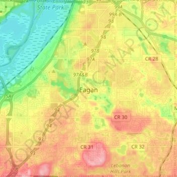
Name: Eagan topographic map, elevation, terrain.
Location: Eagan, Dakota County, Minnesota, United States (44.77563 -93.22787 44.86198 -93.10561)
Average elevation: 267 m
Minimum elevation: 208 m
Maximum elevation: 328 m
Other topographic maps
Click on a map to view its topography, its elevation and its terrain.
Fort Snelling State Park
United States > Minnesota > Dakota County > Eagan
Fort Snelling State Park, Eagan, Dakota County, Minnesota, United States
Average elevation: 246 m