Geolocate

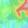
Friedberg (Hessen) topographic map

Click on the map to display elevation.

About this map

Name: Friedberg (Hessen) topographic map, elevation, terrain.

Location: Friedberg (Hessen), Wetteraukreis, Hesse, 61169, Germany (50.28979 8.63653 50.36448 8.82119)

Average elevation: 179 m

Minimum elevation: 115 m

Maximum elevation: 512 m

Other topographic maps

Click on a map to view its topography, its elevation and its terrain.

Der Haag

Germany > Hesse > Wetteraukreis > Melbach

Average elevation: 155 m

Kreischberg

Germany > Hesse > Wetteraukreis > Büdingen

Average elevation: 213 m

Gear up for your next adventure:

🗺️Topographic Maps - Detailed maps for hiking and navigation
🍶Collapsible Water Bottles - Save space in your pack as you consume your water supply
🩹Blister Prevention Tape - Apply to friction points before they become painful sores
🧊Insulated Stainless Steel Flasks - Keep water cold for 24 hours in the heat or coffee hot in the cold
📱Shockproof Phone Cases - Extra protection for your smartphone against drops on rocky terrain

As an Amazon Associate, this site earns from qualifying purchases at no extra cost to you.