Geolocate

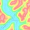
Lyra topographic map

Click on the map to display elevation.

About this map

Name: Lyra topographic map, elevation, terrain.

Location: Lyra, Vernon Township, Scioto County, Ohio, United States (38.71841 -82.75767 38.75841 -82.71767)

Average elevation: 217 m

Minimum elevation: 175 m

Maximum elevation: 282 m

Other topographic maps

Click on a map to view its topography, its elevation and its terrain.
Portsmouth

United States > Ohio > Scioto County

Average elevation: 211 m

Wheelersburg

United States > Ohio > Scioto County

Average elevation: 192 m

Lucasville

United States > Ohio > Scioto County

Average elevation: 179 m

Otway

United States > Ohio > Scioto County

Average elevation: 241 m

Portsmouth

United States > Ohio > Scioto County

Average elevation: 211 m

Gear up for your next adventure:

🛰️Handheld GPS Units - Rugged GPS devices for tracking coordinates and elevation in the Australian bush
🥤Hydration Packs - Hydration systems for hiking
🦯Trekking Poles - Walking poles for hiking stability
🩹Blister Prevention Tape - Apply to friction points before they become painful sores
🦟Heavy Duty Insect Repellent - Essential protection against flies, mozzies, and march flies

As an Amazon Associate, this site earns from qualifying purchases at no extra cost to you.