
Almáskeresztúr topographic map
Interactive map
Click on the map to display elevation.
About this map
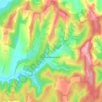
Name: Almáskeresztúr topographic map, elevation, terrain.
Average elevation: 194 m
Minimum elevation: 126 m
Maximum elevation: 268 m
Other topographic maps
Click on a map to view its topography, its elevation and its terrain.
Somberek
Somberek, Mohácsi járás, Baranya vármegye, Zuid-Transdanubië, Transdanubië, 7728, Hongarije
Average elevation: 139 m