Geolocate

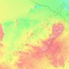
Ash Shinan topographic map

Click on the map to display elevation.

About this map

Name: Ash Shinan topographic map, elevation, terrain.

Location: Ash Shinan, Ḥa'il Province, Saudi Arabia (27.13500 42.40389 27.21500 42.48389)

Average elevation: 903 m

Minimum elevation: 866 m

Maximum elevation: 961 m

Other topographic maps

Click on a map to view its topography, its elevation and its terrain.

Baqa

Saudi Arabia > Ḥa'il Province

Average elevation: 695 m

Hail

Saudi Arabia > Ḥa'il Province

Average elevation: 936 m

Baqa

Saudi Arabia > Ḥa'il Province

Average elevation: 695 m

Arkan

Saudi Arabia > Ḥa'il Province

Average elevation: 1,042 m

Mawqaq

Saudi Arabia > Ḥa'il Province

Average elevation: 1,009 m

Al Dhahira

Saudi Arabia > Ḥa'il Province > Baqa

Average elevation: 695 m

Ash Shinan

Saudi Arabia > Ḥa'il Province

Average elevation: 869 m

Gear up for your next adventure:

📡Weather Radios - Emergency weather radios
🎒Ultralight Backpacks - Lightweight packs for long hikes
📸Action Cameras - Record your journey across interesting topographic features in 4K
📍Handheld GPS - GPS devices for hiking and navigation
🌬️Windbreaker Jackets - Wind protection jackets

As an Amazon Associate, this site earns from qualifying purchases at no extra cost to you.