Geolocate

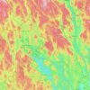
Gustavsfors topographic map

Click on the map to display elevation.

About this map

Name: Gustavsfors topographic map, elevation, terrain.

Location: Gustavsfors, Hagfors kommun, Värmland County, 683 91, Sweden (60.13502 13.78550 60.17502 13.82550)

Average elevation: 220 m

Minimum elevation: 180 m

Maximum elevation: 318 m

Other topographic maps

Click on a map to view its topography, its elevation and its terrain.

Årjängs kommun

Sweden > Värmland County

Average elevation: 168 m

Hammarö kommun

Sweden > Värmland County

Average elevation: 45 m

Arvika kommun

Sweden > Värmland County

Average elevation: 182 m

Glaskogen

Sweden > Värmland County

Average elevation: 194 m

Torsby kommun

Sweden > Värmland County

Average elevation: 356 m

Hammarö kommun

Sweden > Värmland County

Average elevation: 45 m

Säffle kommun

Sweden > Värmland County

Average elevation: 89 m

Kils kommun

Sweden > Värmland County

Average elevation: 104 m

Hagfors kommun

Sweden > Värmland County

Average elevation: 257 m

Filipstads kommun

Sweden > Värmland County

Average elevation: 241 m

Hammarö kommun

Sweden > Värmland County

Average elevation: 45 m

Storfors kommun

Sweden > Värmland County

Average elevation: 158 m

Pottern

Sweden > Värmland County

Average elevation: 145 m

Karlstads kommun

Sweden > Värmland County

Average elevation: 109 m

Sunne kommun

Sweden > Värmland County

Average elevation: 194 m

Gear up for your next adventure:

🔦LED Torches - LED torches for outdoor use
🥾Trail Running Shoes - Shoes for trail running
🍴Titanium Spork & Cutlery - Indestructible and feather-light eating utensils
🧺Waterproof Dry Sacks - Organize your pack and keep electronics safe from rain and river crossings
📍Handheld GPS - GPS devices for hiking and navigation

As an Amazon Associate, this site earns from qualifying purchases at no extra cost to you.