
Sololá topographic map
Interactive map
Click on the map to display elevation.
About this map
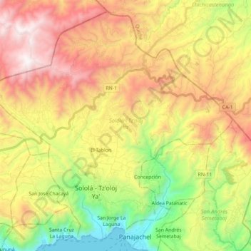
Name: Sololá topographic map, elevation, terrain.
Location: Sololá, Guatemala (14.73908 -91.26261 14.89342 -91.08788)
Average elevation: 2,373 m
Minimum elevation: 1,547 m
Maximum elevation: 3,292 m
Other topographic maps
Click on a map to view its topography, its elevation and its terrain.